Uluru-Kata Tjuta National Park
UNESCO Map
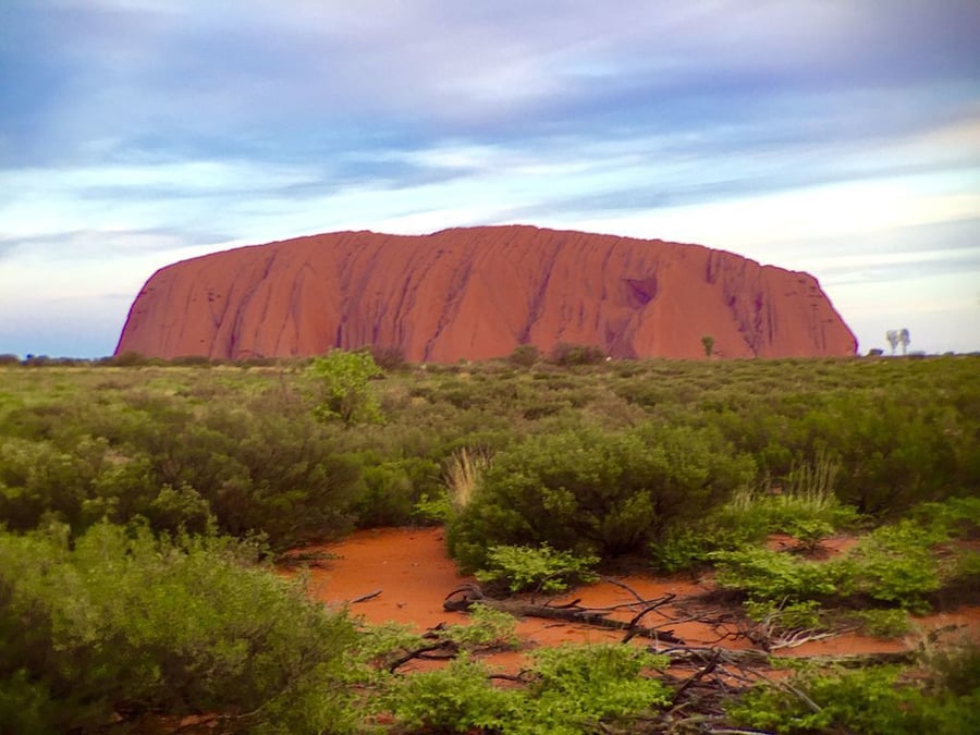
Description: This park, formerly called Uluru (Ayers Rock – Mount Olga) National Park, features spectacular geological formations that dominate the vast red sandy plain of central Australia. Uluru, an immense monolith, and Kata Tjuta, the rock domes located west of Uluru, form part of the traditional belief system of one of the oldest human societies in the world. The traditional owners of Uluru-Kata Tjuta are the Anangu Aboriginal people.
Date inscribed: 1987.0
Area in hectares: 132566
Category specified: Cultural/Natural
State: Australia
Region: Asia and the Pacific
Comments
UNESCO Map was created by Free Custom Map Builder that powers thousands of custom online maps.
Want to build own custom map for your business or community? Try Mapotic's custom map maker and create customizable or branded maps in minutes. Leverage filters, custom categories, crowdsourcing and SEO. Create a free custom map.